|
|
|
|
Gia Lai travel guide
|
Gia Lai (gialai) is a northern
province of the Central Highlands. Gia Lai is bordered with the North
KonTum, on the South by
Dak
Lak, on the West Cambodia and on the East by Quang Ngai, Binh
Binh, Phu Yen.
Gia Lai is linked by high way 14 to Quang Nam -
Da Nang and western highland provinces, linked by highway 19 to coastal central provinces, from Quy Nhon to Pleiku and to North eastern provinces in Cambodia; and by highway 25 to Phu Yen. Gialai province is the source of a system of rivers running down to the Coastal area of central Vietnam and the
Mekong Delta area, and thus plays an important role in the environmental balance of the highlands and the central coastal regions, and has abundant hydroelectric energy. Gialai province occupies the most favorable position in the region for the development of roads and railways, and enjoys the cooperation of Cambodia to the west.
Gialai's area is 15,485 square km's, with a population of 857500 (1995 figures ). The province occupies almost 4,7% of the country' s total land area and its people account for 1.13% of the total population. Demographically, the Viet race account for 52% of Gialai's people, with the remaining 48% composed of other aboriginal minorities: the Jarai people account for 32%. and the Babnar, 13.7%.
As of 1995 available manpower was 386000 laborers or about 45% of the provincial population. Gialai has 11 administrative units: 10 districts and 1 town. Pleiku town, located at the fork of highways 19 and 14, is 180 km away from
Quy Nhon port, and is the administrative economic, and cultural center of the province.
With a tropical highland monsoon climate. Gialai has two distinct seasons: The rainy season begins in May and ends in October, the dry season begins in November and ends in April, The average rainfall of western Truong Son is between 2,200 and 2,500 mm and eastern Truong Son is between 1.200 and 1.700 mm. Annual average temperatures are between 22 and 25 degrees Celsius. Generally speaking, the climate is favorable for short and long term timber production, forestry and cattle production.
Gialai has a long history and an ancient culture that is influenced by ethnic minoritylife, which has been safekept and enhanced . |
 Kon Ka Kinh National Park Kon Ka Kinh National Park |
 |
Area
41,780 ha
Coordinates
14o09' – 14o30'N, 108o16' – 108o28'E
Distance(s)
From Pleiku
From Ho Chi Minh City
Eco-tours
Trekking, Bird watching… Contact us for more information |
 Kon Cha Rang Nature Reserve Kon Cha Rang Nature Reserve |
 |
Province(s)
Gia Lai Area 15,900 ha
Coordinates
14o26' – 14o35'N, 108o30' – 108o39'E
Distance(s)
From Pleiku City From Ho Chi Minh City
Eco-tours
Trekking, Bird watching |
 Xung Khoeng Waterfall Xung Khoeng Waterfall |
 |
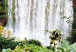
Location: 30 km from the south-west of Pleiku City, Chu Prong District, Gia Lai Province.
Characteristics: Xung Khoeng Waterfall is a beautiful landscape in Gia Lai. |
 Leaving the tomb festival Leaving the tomb festival |
 |
Time: Not fixed, often lasting from 3 to 7 days in spring time
Place: The cemetery
Objects of worship: The deceased people
Characteristics: Rituals of sacrifice offerings, eating, playing of the whole community beside the tomb house. |
 Yaly Hydro-electric Yaly Hydro-electric |
 |
Location: In Ia Mo Nong Commune, Chu Pah District, Gia Lai Province.
Characteristics: It is a beautiful site along Se San River. A new hydro-electric power plant was built at Yaly Waterfall and has a design capacity of 720 MW. |
|
|
|
|
