
Ha Long Bay is located in the northeastern part of Vietnam and constitutes part of the western bank of Bac Bo Gulf, including the sea area of Ha Long City and Cam Pha Town and part of Van Don island district. It abuts
Cat Ba Island in the southwest. Toward the west is the shore with a 120 km-long coastline. It is located within 106o58’-107o22’ east longitude and within 20o45’- 20o50’ north latitude. The site is 1553 sq. km with 1969 islands of various sizes, of which 989 have been named. The islands in Ha Long Bay are mainly limestone and schist islands most lying in the two main areas: the southeastern part of Bai Tu Long Bay and southwestern part of Ha Long Bay. These islands represent the most ancient images of a geographical site having a tectonic age of from 250 million to 280 million years. They are the result of many times of rising and lowering processes of the continent to form a karst. The process of nearly full erosion and weathering of the karst created the unique Ha Long Bay in the world. In a not very large area, thousands of islands with different forms look like glittering emeralds attached to the blue scarf of a virgin. The area where many stone islands concentrate has spectacular scenes and world-famous caves and is the center of Ha Long Bay Natural Heritage, including Ha Long Bay and a part of Bai Tu Long Bay. The area is recognized as the World Natural Heritage that is the area of 434 sq. km with 775 islands. It looks like a giant triangle with
Dau Go Island (in the west), Ba Ham Lake (in the south) and Cong Tay Island (in the east) as its three angle points. The nearby area is the buffer area and areas classified as national beauty spots in 1962 by the Ministry of Culture and Information. |
 History History |
| |
A brief history of this province |
 When to go When to go |
| |
Information on weather, choose the best time for your vacation |
 When to go When to go |
| |
Information on weather, choose the best time for your vacation |
 Health and safety Health and safety |
| |
Important issue about sercurity and decease |
 Getting there and around Getting there and around |
| |
Find how to get to and around this place |
 Geology Geology |
| |
The value of limestone island and grottoes in this area |
 Things to do Things to do |
| |
Suggestions for your vacation |
 Virgin Cave Virgin Cave |
ofcopyofcopyofdaugo1_thumb.jpg) |
Hang Trinh Nu or the Virgin is also known as Mid Gate cave. According to local lore, an old couple lived here long ago. The husband made a living fishing around the bay. They were very poor. They had only one daughter. She grew up to be a beautiful young woman, so beautiful that people from all around knew of her. There were many suitors and her reputation reached the local mandarin. The mandarin immediately sent his soldier to her home to capture her. She was forced to marry the old mandarin. |
 Sung Sot Cave Sung Sot Cave |
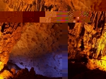 |
The Sung Sot cave is on the same island with Trinh Nu cave. The path to Sung Sot is quite steep and is lined with shady trees. The cave has 2 chambers. The outer chamber is square and is often referred to as the waiting room. The cave's ceiling is approximately 30 m high. The walls are almost perfectly smooth as if it was built by man. The walls generate a variety of colors that blend with the setting of the area. |
 Ba Ham Lake Ba Ham Lake |
 |
Ba Ham Lake is situated in the middle of a narrow, rectangular area, with the all four sides enclosed by vertical cliffs. The lake is a system comprising three wide and round pits, linked together by a narrow and meandering tunnel. Stalactites hang from the ceiling in a myriad of strange, colour forms. The silence is disturbed only by the sounds of the boat’s oars. On the island are many species of plants such as orchids, benjamin figs, banyans and cycads, which blossom throughout the year. It is also the home of yellow-haired monkeys, birds, flying squirrels and bats. Under the deep blue surface of the water are the animated lives of shrimp and fish. |
 Ba Mun Island Ba Mun Island |
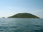 |
The Ba Mun Island is a schist island belonging to Minh Chau Commune, Van Don District, Quang Ninh Province. It stretches out parallel to Quan Lan Island, separated by the Doi Gate that runs in a north-east direction. It has the other name, Cao Lo Island. |
 Bai Chay Beach Bai Chay Beach |
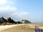 |
Bai Chay is a low gently sloping range of hills that runs along the sea for more than 2 km. Blended in among the pine trees are large hotels and small villas with distinguished architectural styles. Traveling down the asphalt road along the coast, visitors see long white stretches of sand and green rows of Casuarina trees, tucked under which are small family-run restaurants |
 Dau Go Grotto Dau Go Grotto |
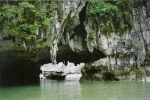 |
The Dau Go Grotto is found on Driftwood Island, formerly known as Canh Doc Island. The name Driftwood Grotto comes from the popular story of the resistance war against the Nguyen Mong aggressors. In a decisive battle, Tran Hung Dao was given an order to prepare many ironwood stakes to be planted on the riverbed of the Bach Dang River. |
 Tuan Chau Island Tuan Chau Island |
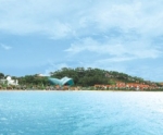 |
The Tuan Chau Resort was newly built on a location 8 km from the centre of Ha Long City. It stretches for 220 ha and built of gradual hills. A 2-km cement road connects the island with the mainland. Many constructions in Tuan Chau are underway or have been finished. From the entrance you will pass a cluster of hills |
 Thien Cung Grotto Thien Cung Grotto |
 |
VietNamNet - Situated in the northeast region of Vietnam, Halong Bay is settled in the Gulf of Tonkin comprising of more than one thousand limestone karsts and islands of different sizes and shapes, along a 120-kilometre coastline. |
